

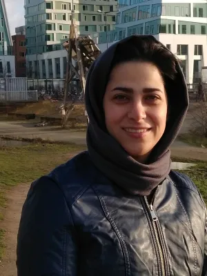
Behshid Khodaei
Researcher
Behshid is a PhD student affiliated with both Center for Advanced Middle Eastern Studies (CMES) and Water Resources Engineering division at Department of Building and Environmental Technology, Faculty of Engineering (LTH) at Lund University. She has received her BSc and MSc degrees in Geomatics and Remote Sensing engineering from Isfahan University and Tehran University.
Her research interests include spatial data analysis for environmental applications, Interferometric SAR (InSAR) analysis and its applications in monitoring of earth surface and management of water resources, as well as the applications of Artificial Intelligence (AI) and Machine Learning (ML) algorithms along with remote sensing data for environmental monitoring purposes.
Publications
Displaying of publications. Sorted by year, then title.
Water Storage Capacity Dynamics in Drained Boreal Peatlands : Responses to Rewetting and Climate Change
Shokoufeh Salimi, Behshid Khodaei, Hjalmar Laudon
(2026) Geophysical Research Letters, 53
ArticleSIGH-Map: Space-time InSAR-based groundwater head mapping: An integrated InSAR-MODFLOW framework for head calculation
Hossein Hashemi, Farzaneh Nazarieh, Behshid Khodaei
(2026) Journal of Hydrology: Regional Studies
ArticleSatellite-based assessment of upstream regulation impacts on downstream reservoir dynamics and agricultural activity between the Turkey and Syria
Behshid Khodaei, Pinar Dinc, Mo Hamza
(2026)
AbstractGround deformation and groundwater dynamics : the role of interferometric synthetic aperture radar analysis in confined aquifer systems
Hossein Hashemi, Alireza Taheri Dehkordi, Behshid Khodaei, Seyed Amir Naghibi
(2026) Water Scarcity Management: Toward the Application of Artificial Intelligence and Earth Observation Data , p.223-238
Book chapterA Novel Approach to Aquifer Classification Using Hysteresis Loop Analysis and Deep Learning for Sustainable Groundwater Management
Behshid Khodaei, Hossein Hashemi, Mazda Kompani-Zare
(2025)
AbstractGroundwater Level Retrieval Using Temporal Integration of Sentinel-1 InSAR Time-Series and Recurrent Neural Networks
Alireza Taheri Dehkordi, Behshid Khodaei, Hossein Hashemi, Amir Naghibi
(2025)
AbstractFrom Deformation to Hydrology A Comparative Evaluation of InSAR and Modelling Techniques for Assessing Water Availability in Varied Hydrological Systems
Behshid Khodaei
(2025)
Doctoral Thesis (compilation)An integrated InSAR-numerical approach for accurate groundwater head prediction
Behshid Khodaei, Hossein Hashemi, Mazda Kompani-Zare, Seyed Amir Naghibi, Ronny Berndtsson
(2025) Journal of Hydrology, 662
ArticleInsights into the Interconnected Dynamics of Groundwater Drought and InSAR-Derived Subsidence in the Marand Plain, Northwestern Iran
Saman Shahnazi Mansouri, Kiyoumars Roushangar, Behshid Khodaei, Hossein Hashemi
(2025) Remote Sensing, 17
ArticleA Numerical Method for InSAR-Based Estimation of Head Changes using Storativity Parameters
Behshid Khodaei, Hossein Hashemi, Mazda Kompani-Zare, Seyed Amir Naghibi, Ronny Berndtsson
(2024)
AbstractCan river flow prevent land subsidence in urban areas?
Alireza Sharifi, Behshid Khodaei, Amirhossein Ahrari, Hossein Hashemi, Ali Torabi Haghighi
(2024) Science of the Total Environment, 917
ArticleInSAR-AI-Based Approach for Groundwater Level Prediction in Arid Regions
Behshid Khodaei, Hossein Hashemi, Seyed Amir Naghibi, Ronny Berndtsson
(2023)
Paper, not in proceedingSubstantial carbon sequestration by peatlands in temperate areas revealed by InSAR
Behshid Khodaei, Hossein Hashemi, Shokoufeh Salimi, Ronny Berndtsson
(2023) Environmental Research Letters, 18
ArticleAn Integrated InSAR-Machine Learning Approach for Ground Deformation Rate Modeling in Arid Areas
Seyed Amir Naghibi, Behshid Khodaei, Hossein Hashemi
(2022) Journal of Hydrology, 608
ArticleEstimating peatland carbon sequestration in southern Sweden using InSAR
Behshid Khodaei, Hossein Hashemi, Ronny Berndtsson
(2022)
Abstract3D SURFACE GENERATION FROM AERIAL THERMAL IMAGERY
Behshid Khodaei
(2015) International Archives of the Photogrammetry, Remote Sensing and Spatial Information Sciences - ISPRS Archives
Articleارائه یک روش بهبود یافته در آشکار سازی تغییرات با تاکید بر تاثیر نویز لکه ای در تصاویر با روزنه ترکیبی
Behshid Khodaei, Jalal Amini, Mahdi Momeni
(2012) Journal of Geomatics Science and Technology, 2
Article
Research Project
Current Project at CMES
Comparative Water Resources Availability in the Middle East (2021-ongoing), funded by the MECW Research Program